Thursday, July 18, 2024

Fish story

Hubby put a lot of planning into this trip.  He researched, booked ahead for spots in popular areas, like the national parks and on the ferries.  He planned out the entire route in detail so that we could see everything.  


But there are always things you can’t plan for.  It turned out that we were just a little too early for the whales in the southeast, and when we got north we were a little too late for the icebergs.  And the rolling of the Caplin (which I hear is a sight to see - tiny fish mating on the beaches in one moving mass) we missed that by one day.  Because the capelin don’t go to all the beaches at the same time, one has to try to find them wherever or whenever they may land.  And they are fast little critters. 


We saw lots of other things.  Mountains, ancient rocks, unique fishing villages.  We hit as many museums as we could, learning about the early peoples and their lifestyles, and also the European visitors who often only came for the summer fishing. This rocky island in the North Atlantic was so rich in fish stock, that Europeans made treaties dictating where along its shores each country could fish. Totally leaving the native population out of the equation.


Unfortunately they did such a good job fishing that the fish eventually could not rebuild to the level that it was.   Now, some 500 years later, Newfoundland has become quite protective of its fish stock.  All the sea bound rivers that we passed are highly regulated as to when, how, and how much you can fish.  Any trout or salmon in those rivers can only be caught by fly fishing, and there is an annual limit of only two salmon per fisherman.  Each fish caught must be tagged, like in moose hunting, and trust me, the wardens are watching.  


We went on over to Labrador for two reasons.  It gave us an opportunity to see another part of Canada that we’ve not yet seen, and a chance for us to continue learning the fishing history of Newfoundland.  There definitely was a lot of fishing for cod and other fish off the coast of Labrador, but the more important resource that was taken from that area were the whales.  


Europeans again came for the summer months to catch the slow moving right whales that followed the krill up the strait between the two land masses.  They only stopped coming when the number of whales swimming up the strait diminished. Either from over hunting, or because the mammals recognized that area as a Bermuda Triangle of sorts. 


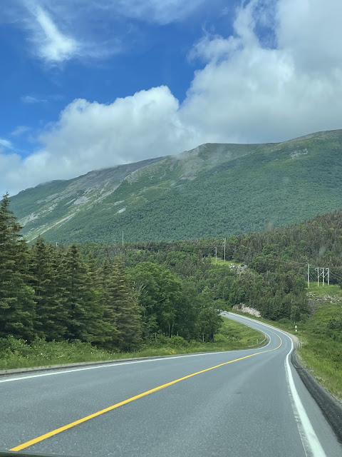
Labrador shouldn’t have been a surprise, but it was.  We took the ferry from the northern tip of  Newfoundland, where the mountainous terrain of the rest of the island had finally smoothed out to mostly flat caribou land. Only 20 kms separate the two, and yet driving up the Labrador coast was like driving up the Gaspe coast. We could literally look across the strait to the flatter tundra of the island as we climbed steep hills and then had to brake all the way down the other side because of the town below.  


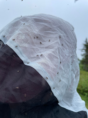
What wasn’t a surprise, but was not pleasant, were the black flies.  We were prepared and had brought bug shirts, but the swarms were determined to enter the trailer with you and stuck to your hair and clothes when you opened the door.  A bug invasion in our tiny space was not welcome.  


I was in awe of the park official that took no notice of them when outdoors. But I was horrified when he said that they appear in May and don’t leave until September.  Kinda sounds like those foreign fishermen.  Or bad tourists.  


Well, I can promise everyone that we learned from the past and did not just come to take the fish and leave.  


My hubby tried, but couldn’t catch a thing.  


W

Thursday, July 11, 2024

Gros Morne

Gros Morne National Park is a big place.  It’s perched on the western side of Newfoundland, and it holds a lot of history.  Both in human records and in geological eras.  It encompasses 5 villages and many different types and ages of rock.  There are so many diverse parts, that it’s hard to explain it in just one go.  But I’ll try.  


The biggest area on the southern end of the park is called the Tablelands.  It is a flat, orangey range that appears desolate and empty of life, especially in comparison to the green hills around it. It has actually been used to represent Mars!  


The geological importance of this range is that it’s considered to be the oldest rock visible on earth.  It was pushed up from the mantle, which is below the earth’s crust and just above the earth’s core.  A freshly broken chunk of rock from here is a very dark green colour, but it oxidizes in the air and becomes a rusty shade over time.  


The trail to the base is a very popular walk, and because there is no vegetation to disturb, one is allowed to climb to the top if one really wants to attempt the scramble.  With warnings posted that rocks could shift at any time. 


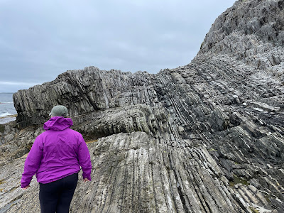
With rocks being the name of the game here, we also walked the coastline around Green Point. The shale sedimentary rocks from the bottom of an old sea alternating with ribbons of limestone had been pushed up vertically along these cliffs, exposing them to geologists and tourists alike. The geologists at least are very enthusiastic about these cliffs as they hold fossils from two different geological eras.  


But however interesting they are, I found them very hard to walk across. The shale was in thin strips and very sharp. 


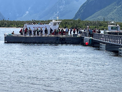
An easier trip that we took was to the Western Brook Pond. It involved a boat trip.  The boat was smaller than I had expected, with a safe capacity (or so I was told) of 99 people.  There were not 99 seats on the boat.


  Not that it mattered, because most of the passengers were trying to crowd themselves to the front or the back just to get the best views.  I’m pretty short.  I got the best views of other people. 


Nonetheless, the views I did get were stupendous with towering cliffs over the water.  


And finally, there is Gros Morne.  The mountain that the park is named after.  When we first arrived, it was a very foggy day. Based on the map I was following, I gestured to the right at the proper time and said, “there’s a big mountain there!”, knowing that all we could see was white fog.  


It was almost disappointing when the fog lifted and we saw the round mass of Gros Morne. It is nothing like the craggy and steep forms that surround it. Yes, it is big, but far from imposing. 


That is, until you try to hike it.  I attempted the first half, but gave up.  And I hadn’t even reached the bottom of the mountain. You have to hike four and a half kilometres, uphill, only to reach the point where they post warnings about continuing to the top.  The warnings make clear that it’s a one way loop around from there, meaning even if you give up, you can’t turn around and go back.  The entire trek is 17.4 kms.  


Although I conceded defeat, my hubby went back early the next morning determined to reach the summit.  Beyond the several warnings, there are loose rocks to scramble over. 


With no soil, you have to rely on arrows pointing the route. I’m proud to say he made it to the top, and all before his breakfast.  


But if going up was bad, so was the return trip.  I understand the view was wonderful up there, not that it encourages me to attempt the task.  


I certainly haven’t been able to describe all that we saw and did in our 10 days in Gros Morne.  We were able to spend time in most of the seaside villages. Hubby took a couple of park ranger guided tours on plants used by the natives for medicines and healing. 

We stayed in one of four campgrounds inside the park. The water provided had a lovely tinge of brown, and we were told to boil before drinking. But along the highway we found a spring gushing out of the cliffs. Fresh, clear, and cold.  And since we had to boil anyway, it just made sense to use the stuff that at least looked good.  Trust me, we weren’t the only ones.  The spring had a parking space and a wooden plank to put your bottles on.  And occasionally, a lineup.  


We didn’t always hike just for the views. Oft times, it was the best way to get a cell signal. 


Gros Morne Park is a big place, after all.  


W


Sunday, June 30, 2024

Fishing Villages


We’ve seen a lot of fishing villages. A lot.  We had a goal to see as many as we could on this trip, believing that by seeing the small places, you learn more about the people in the area.  City people are mostly all the same.  The heart of a place is in the small towns and villages. 


And even though we’re not done yet, we’ve learned a few things about the fishing villages in Newfoundland.  


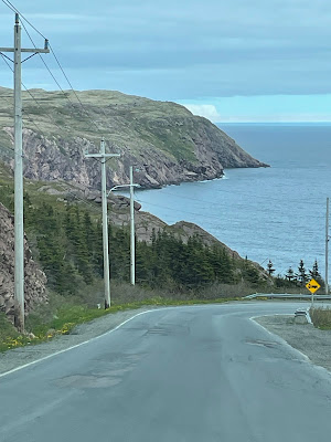
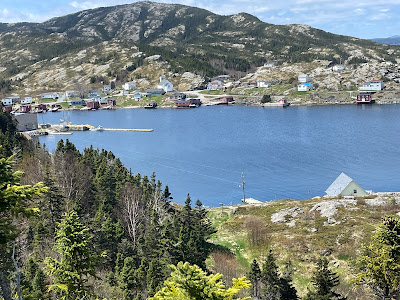
1.  All fishing harbours are on the other side of a range of mountains.  It means a climb and then a steep descent to get there, but you get an awesome view of the harbour coming down.  


2.  Village people are very friendly, and very willing to talk and answer questions.  They don’t seem to be in a rush to go do something else.  Talking to you is their primary focus.  And if you want anything, they’ll likely offer it to you.  We’ve been freely given a chunk of iceberg, offered cod filets directly from someone else’s freezer, and a fellow we met at the waterfront invited us to “drop by” anytime. He even told us where he lives. 


They have many good artists among them.


And a great sense of humour. 


3.  All Newfoundlanders like colour.  They paint their houses, sheds, garbage bins, even the school bus stops brilliant and often contrasting colours. 


And the doors rarely match the house.  


4.  Home Hardware is every where.  It probably makes a fortune in selling paint and supplies.  And other house maintenance tools.  Newfoundlanders take a lot of pride in their houses.  It makes it a pleasure to slowly cruise through their streets and admire the well kept homes and yards.  


Time to move on to the next village.  


W