Tuesday, June 4, 2024

TCH


Acronyms are funny.  

In Canada, THC often means pot


In Newfoundland, TCH often means potholes. But at least they warn you. 


The TransCanada Highway, or TCH as it’s known locally, is the main transportation link around the “ROCK”.


As the crow flies, the distance between Port Aux Basques, where the ferry lands, and St. John’s, is just over 500 kms. But maybe crows don’t fly straight in Newfoundland. For sure, the TCH doesn’t.  Because driving from the ferry to the city is 902 kms.  


Even though St John’s is directly east of Port Aux Basques, the first direction the road goes is northwest for about 30kms before angling northeast for another 365kms. Talk about taking the long way around the island.  


For all that the TransCanada is the main road in Newfoundland, very little of it is divided highway, even though the speed limit is 100 km/hour. It is also surprisingly not a very heavy traffic road, so occasional passing lanes are sufficient to keep any build up of cars behind our slower rig.  


You are warned many times, and in many ways, about moose hazards along the route.  It appears that collisions with those huge animals is the most dangerous part of the drive. We learned that moose are in fact not native to Newfoundland.  They were imported in 1904 to provide lean meat for hunters.  And with no other natural predators, their population exploded. We have seen traces of them along the hiking trails. But for all the cautions and warnings, and watching very carefully, so far we have not seen one. 


The other thing about such a main route is that there are no provincial rest area plazas.  There are a few gas stations right off the highway, but not many unless you get off the main road and go into a small town. What they do have, however, are several pull-offs with no facilities.  It is common to have transports and even campers parked there overnight to break up the drive. 


And you have to keep an eye on the weather as well as the wildlife. Just to make things interesting. This is just fog, no heavy downpour yet. Yet. 


It’s a long road, so you have plenty of time to look around. And the views are remarkable. 
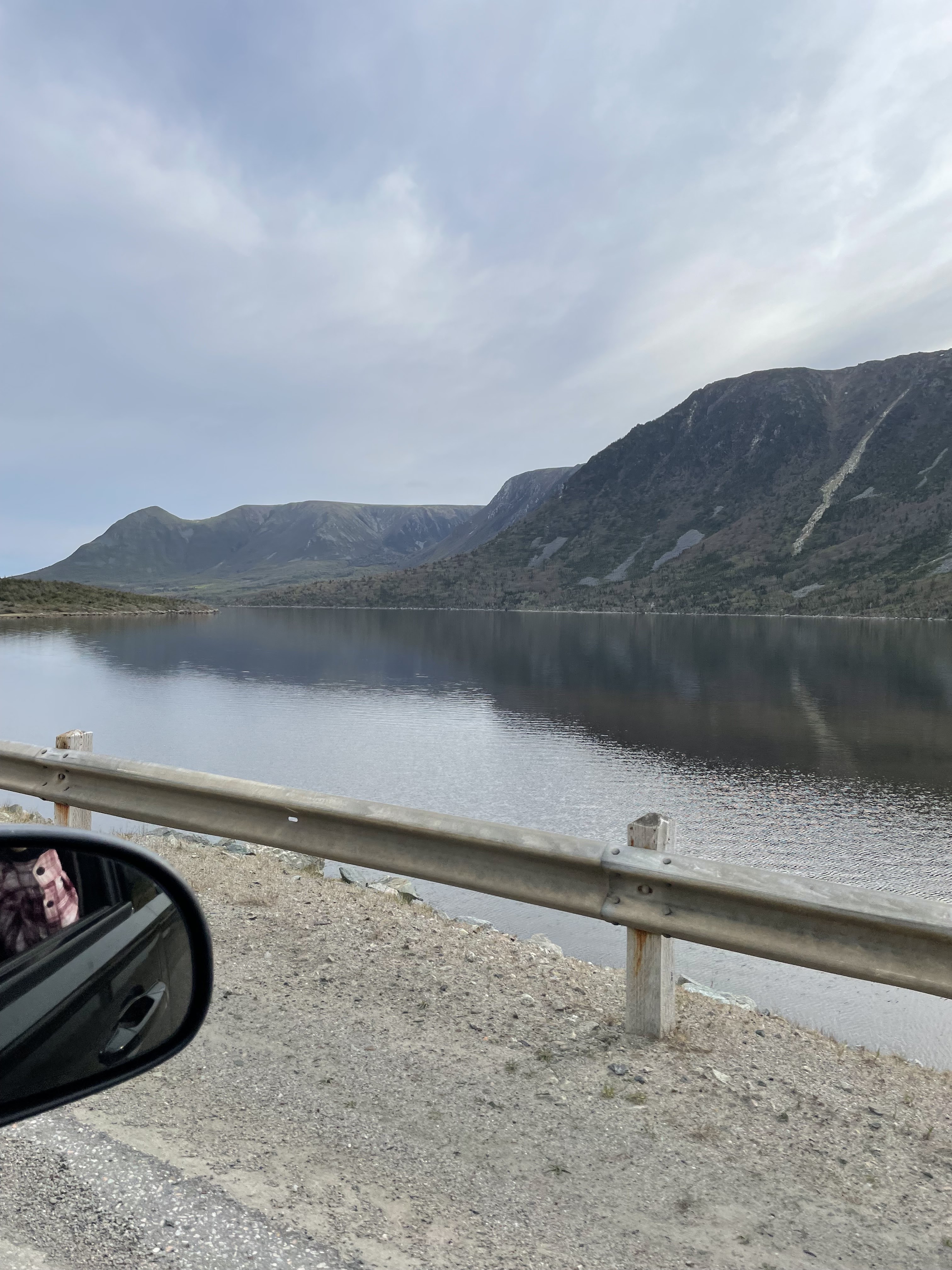


You can get a different kind of high from the TCH. 

Just watch out for potholes. 


W


Tuesday, May 28, 2024

The Damnable Trails


We landed at Terra Nova Provincial Park on Thursday. It poured rain from Friday through to Sunday, with even a thunderstorm thrown in.  


On Monday, the sun came out. And so did we. 


At the end of a peninsula near the park is a fishing town called Salvage established in 1600’s. And a series of trails called The Damnable Trails.  


Sounded intriguing.


On a flat trail, I can easily cover 4 km in less than an hour. The total distance we did on these trails was 5.5km.  And it took us 3 hours.  


Yes, we did stop at all the overlooks and hubby threw a fishing line in at one cove, but mostly what slowed me down was the steep climbs and tricky descents. All while navigating tree roots and rocky spots. 


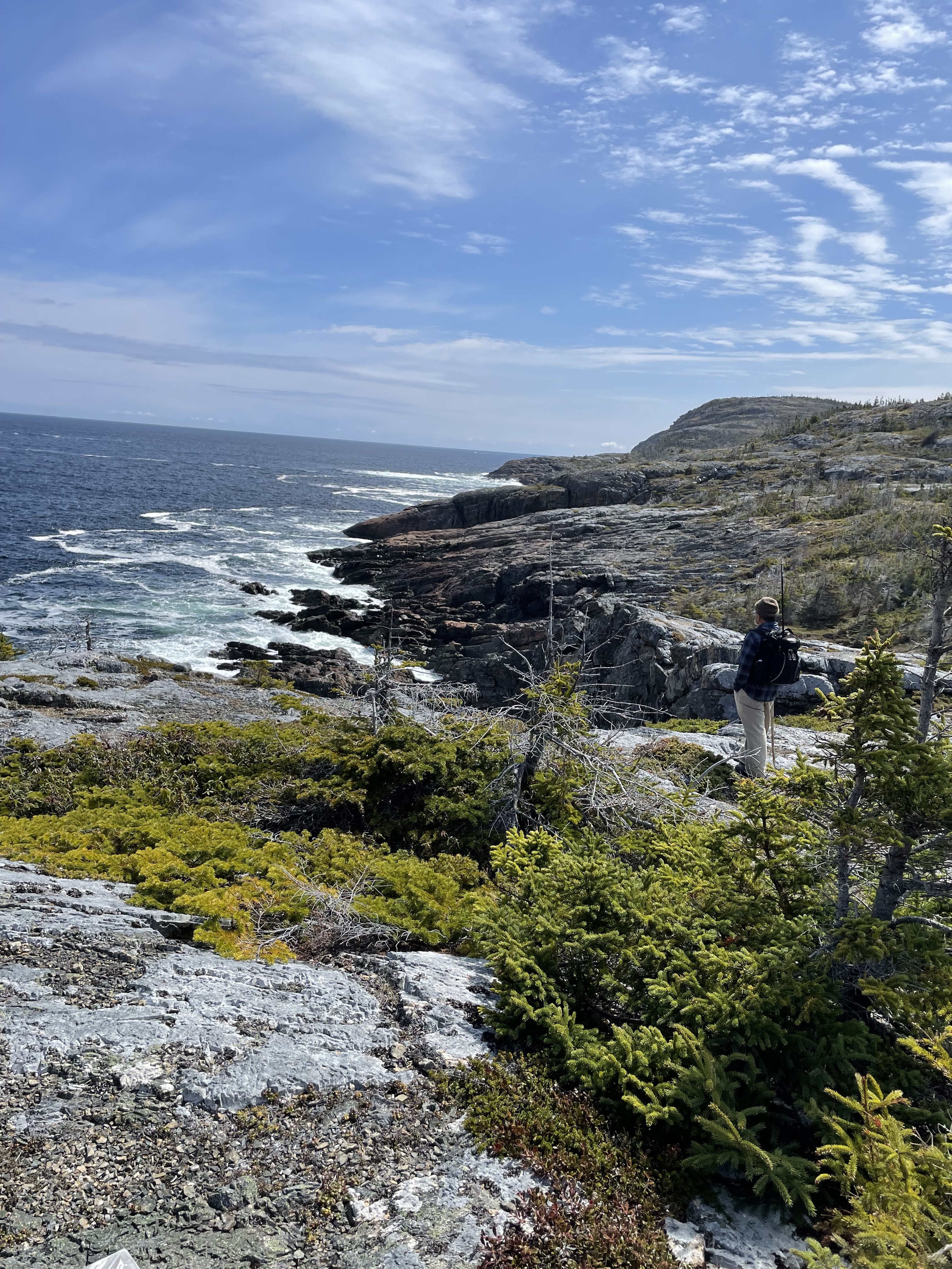
And I did stop to take pictures. It was irresistible to try to capture the wildness of the coast. 


And the view of the town across the bay. 


But mostly I laboured up the hills, gasping for breath at the top, and gingerly found my footing on the way down. We opted out of the last trail, to the summit of the largest hill behind us.  And voted to hit the pub in town instead. 


But the pub was closed. 


That damnable trail.  


W


Friday, May 24, 2024

Sailing East

Sailing East


Going to Newfoundland is not something to be done on the spur of the moment. Doing it right requires a massive commitment of time and effort.  You could fly in and just see the city, but to really experience this place, give yourself the time to drive around the province and meet the people. 


Getting there by car is the first commitment.  Taking the ferry means making a reservation often several months in advance. We booked in February, but were still unable to get a ride on the day ferry coming back at the end of July.  We did get on the list for the night ferry but all the sleeping cabins were reserved already, meaning we will have to make do with sitting up all night.  As someone who turns into an ogre at night, I don’t envy my hubbie on that trip. 


Our first sight of the ferry on our way to the island was coming down the hills of North Sydney in Cape Breton.  It looked like a cruise ship, and in fact there are 3 floors for passengers. 


 Following instructions, we lined up waiting to load more than 2 hours before it was due to depart.

 Eventually they directed us into this cavernous space, parked us, and sent us up to the passenger levels with the instruction that we could not return to our vehicle until after landing. They then proceeded to load several dozens of transport trucks alongside our cars and campers, as well as on another level above that. 


We found our assigned seating and also the sun deck on top of the boat.  With the sun out and shining, we watched the final departure from above and felt the rumble of the engines working hard to move this huge vessel full of trucks away from shore and into the North Atlantic. 


The sailing usually takes about 7 hours, but the waters were calm and it was a smooth ride. 


The most terrifying part was trying to find our truck crammed in among huge transports. There was barely room for an adult to slide in between these behemoths while nervously watching them in case they moved.  Of course, our truck was several lanes away and a few rows up.  Not that we could see our little vehicle in amongst the others. 


After unloading we got our first look at the Newfoundland landscape.  We drove alongside a long range of snow capped mountains to our first campsite, a mere 15 minutes away.  Back on solid ground!


W

Monday, August 7, 2023

The Ups and Downs of Gaspe Peninsula


The mountains of Gaspe are part of the Appalachian Range that starts down in South Carolina and runs right up until it hits the Gulf of St. Lawrence. At that point it dives under the Gulf and reemerges as Newfoundland.


We drove all around the Gaspe coast to see these awe-inspiring views. Nature at its most amazing.  The geology is mind-boggling. Folded rocks and sheer cliffs are prominent.


We drove up the many steep hills, invariably gliding back down a slope to the small fishing towns in the coves at the bottom. Fun times. 

Hard acceleration going up, using our brakes coming down. Wonderful if you are on a motorcycle.  More of an adventure pulling a trailer.


We went from the wet days and that one torrential rainstorm in Halifax, and into 9 lovely days of sun. Our first stop was in Kouchibouguac National Park.


We were able to paddle down the Kouchibouguac river and into a very shallow lagoon that was protected by a sandy barrier island. And when it got too shallow to paddle – the tide going out, and all – we walked the boardwalk over to the sunny, sandy beach on the other side.


While we were paddling the river, hubby was tempted by the thought of clamming.  When the tide goes out, the clammers scour the mudflats of the river for little airholes, or dimples, that could indicate a clam resides in the mud.  One then digs it out with a shovel to disturb its resting place. I argued that the beach would be a much nicer place to spend a sunny afternoon than trudging through mud.

At our next stop further up the coast, we paddled down the Tabusintac river.  There are more serious clammers in that area.  They don’t wait for the tide to expose the mud.  They don snorkeling gear and pick up the clams from the riverbed while the water is still 3 or 4 feet deep! Tempting, but we weren’t about to do that.  It’s much easier to visit the many fish stores along the coast. 


The most famous place to stop along the Gaspe is Perce Rock. It is so big that we could see it in the distance.


But the town of Perce is very small and a lot of people want to get up close to see this monolith towering over the mainland.   Parking a truck and a trailer – even a short one – was a bit of a challenge.  Parking lots for cars won’t work, especially when they are already full. And there are no Walmart’s or other box stores in the area. Fortuitously, we found a Catholic church that was willing to sell us a parking spot behind the church – and beside the cemetery – for $15.


Driving the ups and downs of Gaspe was interesting, but it was another challenge altogether doing the hiking trails that we followed at Forillon National Park, at the far eastern end of Gaspe, called “Land’s End”. Even the accessible trail was a long and steep uphill to get to the lighthouse on the end of Cape Gaspe.


The less accessible trail was to the top of Mont Saint-Alban. When I first saw the destination at the top of the trail, it was from the side of the shore.  You can see the observation tower that we were supposed to get to, at the top of this photo. Those are sheer cliffs in front of it.


Somehow, I was supposed to navigate those cliffs to the observation tower up there.  I gave my hubby notice that I might bail at any time, and then determinedly started up.  It wasn’t nearly as bad as I had feared.  Not once did they make the trail along the cliff.  The rough trails were steep, but doable.


Going up was hard enough work that I was happy to come down.

 And in such a beautiful place, my mood was up.

W